
Katra topographic map
Click on the map to display elevation.
Katra
Katra is located at 32°59′N 74°57′E / 32.98°N 74.95°E / 32.98; 74.95. It has an average elevation of 875 metres (2,474 feet). The Banganga River passes through the village.
About this map
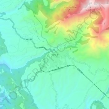
Name: Katra topographic map, elevation, terrain.
Location: Katra, Reasi, Reasi district, Jammu and Kashmir, 182301, India (32.95249 74.89181 33.03249 74.97181)
Average elevation: 993 m
Minimum elevation: 465 m
Maximum elevation: 2,651 m