Geolocate

Silghat topographic map

Click on the map to display elevation.

About this map

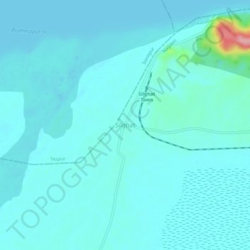
Name: Silghat topographic map, elevation, terrain.

Location: Silghat, Kaliabor, Nagaon, Assam, 782143, India (26.58152 92.90608 26.62152 92.94608)

Average elevation: 71 m

Minimum elevation: 57 m

Maximum elevation: 191 m

Gear up for your next adventure:

🎒Hiking Backpack - Lightweight and ergonomic backpacks for day hikes or multi-day treks
🥾Hiking Shoes - Durable and comfortable shoes for trail hiking
📷Outdoor Action Camera - Capture high-elevation views and rugged adventures
🧊Insulated Water Bottle - Keeps drinks cold in summer and prevents freezing in winter
🧣Merino Neck Gaiter - Protects against wind, sun, and cold at high altitudes

As an Amazon Associate, this site earns from qualifying purchases at no extra cost to you.