Geolocate

Shyville topographic map

Click on the map to display elevation.

About this map

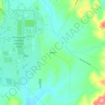
Name: Shyville topographic map, elevation, terrain.

Location: Shyville, Pike County, Ohio, 45687, United States (38.98705 -83.00465 39.02705 -82.96465)

Average elevation: 217 m

Minimum elevation: 181 m

Maximum elevation: 325 m

Other topographic maps

Click on a map to view its topography, its elevation and its terrain.

Waverly

United States > Ohio > Pike County

Average elevation: 192 m

Pike Lake

United States > Ohio > Pike County

Average elevation: 303 m

Pebble Township

United States > Ohio > Pike County

Average elevation: 276 m

Gear up for your next adventure:

🧥Waterproof Hiking Jacket - Protect yourself from rain and wind while hiking
🥾Approach Shoes - Shoes designed for climbing approaches and rugged trails
🥾Mountain Trail Shoes - High-traction shoes for mountain trails
🥽Outdoor Goggles - Protective eyewear for outdoor activities
🔥Emergency Fire Starter - Reliable ignition source for all weather conditions

As an Amazon Associate, this site earns from qualifying purchases at no extra cost to you.