Geolocate

Cascata topographic map

Click on the map to display elevation.

About this map

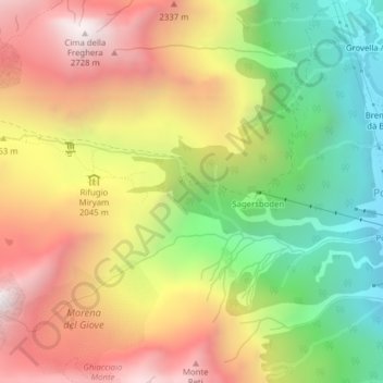
Name: Cascata topographic map, elevation, terrain.

Location: Cascata, Formazza, Verbano-Cusio-Ossola, Piedmont, 28863, Italy (46.37737 8.40395 46.37747 8.40405)

Average elevation: 1,990 m

Minimum elevation: 1,300 m

Maximum elevation: 2,693 m

Gear up for your next adventure:

🧥Waterproof Jacket - Lightweight rain jackets for hiking and outdoor activities
🥾Waterproof Hiking Shoes - Durable shoes for wet and rugged trails
🪑Ultralight Camping Stool - Compact seating for rest stops during long hikes
🌡️Emergency Mylar Blankets - Compact thermal protection for unexpected nights outdoors
Camping Coffee Maker - Brew fresh coffee anywhere on the topographic map

As an Amazon Associate, this site earns from qualifying purchases at no extra cost to you.