Geolocate

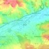
Altendorf topographic map

Click on the map to display elevation.

About this map

Name: Altendorf topographic map, elevation, terrain.

Location: Altendorf, Landkreis Bamberg, Bavaria, 96146, Germany (49.78132 10.96950 49.81360 11.04884)

Average elevation: 273 m

Minimum elevation: 241 m

Maximum elevation: 353 m

Other topographic maps

Click on a map to view its topography, its elevation and its terrain.
Wind

Germany > Bavaria > Landkreis Bamberg

Average elevation: 284 m

Gear up for your next adventure:

💧Reusable Water Bottle - Durable water bottles for hydration on trails
🧴Insect Repellent - Protect yourself from bugs during outdoor adventures
🧣Evaporative Cooling Towel - Beat the heat during intense summer climbs
🥾Approach Boots - Comfortable boots for hiking and climbing approaches
🔋Emergency Crank Radio - Weather alerts and power without needing batteries

As an Amazon Associate, this site earns from qualifying purchases at no extra cost to you.