
Thank you for supporting this site ❤️
Make a donation
Make a donation
Gear up for your next adventure:
As an Amazon Associate, this site earns from qualifying purchases at no extra cost to you.
Castelpoggio topographic map
Click on the map to display elevation.
Thank you for supporting this site ❤️
Make a donation
Make a donation
Gear up for your next adventure:
As an Amazon Associate, this site earns from qualifying purchases at no extra cost to you.
About this map
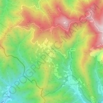
Name: Castelpoggio topographic map, elevation, terrain.
Location: Castelpoggio, Carrara, Massa-Carrara, Toscana, 54033, Italia (44.09226 10.05488 44.13226 10.09488)
Average elevation: 501 m
Minimum elevation: 102 m
Maximum elevation: 975 m
Thank you for supporting this site ❤️
Make a donation
Make a donation
Gear up for your next adventure:
As an Amazon Associate, this site earns from qualifying purchases at no extra cost to you.