Geolocate

Medulla topographic map

Click on the map to display elevation.

About this map
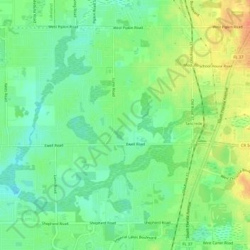
Name: Medulla topographic map, elevation, terrain.

Location: Medulla, Lakeland, Polk County, Florida, United States (27.93846 -82.01265 27.97485 -81.96018)

Average elevation: 43 m

Minimum elevation: 26 m

Maximum elevation: 66 m

Other topographic maps

Click on a map to view its topography, its elevation and its terrain.

Lakeland

United States > Florida > Polk County > Lakeland

Average elevation: 42 m

Gear up for your next adventure:

👟Trail Running Shoes - Agile footwear for fast-paced topographic exploration
🧢Sun Hat - Wide-brim hat for sun protection
🚲Bike Repair Kit - Essential tools for on-trail mechanical issues
🦶Anti-Blister Balm - Prevents friction and hotspots during long ascents
🧼Travel Hand Sanitizer - Keep hands clean when water is scarce

As an Amazon Associate, this site earns from qualifying purchases at no extra cost to you.