Geolocate

Bulnes topographic map

Click on the map to display elevation.

About this map
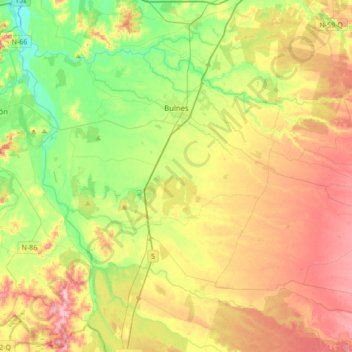
Name: Bulnes topographic map, elevation, terrain.

Location: Bulnes, Provincia de Diguillín, Nuble Region, 3930000, Chile (-36.90161 -72.45210 -36.68992 -72.10799)

Average elevation: 102 m

Minimum elevation: 24 m

Maximum elevation: 202 m

Other topographic maps

Click on a map to view its topography, its elevation and its terrain.
Gear up for your next adventure:

📷Outdoor Action Camera - Capture high-elevation views and rugged adventures
🚑Survival Whistle - Signal for help across long distances in mountains
🥾Mountaineering Boots - Supportive boots for climbing and high-altitude hiking
🧦Thermal Socks - Warm socks for winter hiking or camping
🛶Kayak Dry Bag - Waterproof storage for kayaking adventures

As an Amazon Associate, this site earns from qualifying purchases at no extra cost to you.