Geolocate

Zamora topographic map

Click on the map to display elevation.

About this map

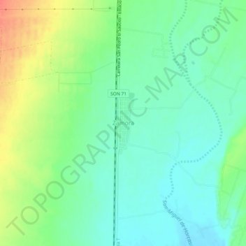
Name: Zamora topographic map, elevation, terrain.

Location: Zamora, Hermosillo, Sonora, Mexico (29.24033 -110.90631 29.28033 -110.86631)

Average elevation: 287 m

Minimum elevation: 269 m

Maximum elevation: 319 m

Other topographic maps

Click on a map to view its topography, its elevation and its terrain.

Gear up for your next adventure:

🧴Insect Repellent - Protect yourself from bugs during outdoor adventures
🔭Outdoor Binoculars - Lightweight binoculars for birdwatching and hiking
🚲Heavy Duty Bike Lock - Secure your bike at the trailhead or during stops
Lightweight Backpacking Tent - Compact tent for efficient hiking trips
🧤Rechargeable Heated Gloves - Extreme warmth for Canadian winter expeditions

As an Amazon Associate, this site earns from qualifying purchases at no extra cost to you.