Geolocate

Yongchun topographic map

Click on the map to display elevation.

About this map

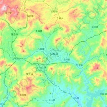
Name: Yongchun topographic map, elevation, terrain.

Location: Yongchun, Taocheng, Yongchun County, Quanzhou, Fujian, China (25.16420 118.12958 25.48420 118.44958)

Average elevation: 410 m

Minimum elevation: 39 m

Maximum elevation: 1,354 m

Gear up for your next adventure:

🌬️Windproof Camp Stove - Efficient cooking even on exposed mountain peaks
🧢Hiking Hat - Sun-protective and breathable hats for long treks
🕶️Polarized Sunglasses - Protect your eyes with durable polarized lenses
🥾Hiking Shoes - Durable and comfortable shoes for trail hiking
🧢Outdoor Cap - Protective cap for sun and rain during hikes

As an Amazon Associate, this site earns from qualifying purchases at no extra cost to you.