Geolocate

Jerez topographic map

Click on the map to display elevation.

About this map

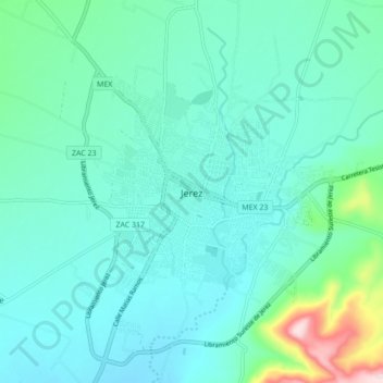
Name: Jerez topographic map, elevation, terrain.

Location: Jerez, Zacatecas, 99300, Mexico (22.60944 -103.03003 22.68944 -102.95003)

Average elevation: 2,022 m

Minimum elevation: 1,968 m

Maximum elevation: 2,292 m

Gear up for your next adventure:

🧥Thermal Layer - Insulating layer for cold outdoor conditions
🔭Compact Binoculars - Lightweight optics for scouting trails and wildlife
🧦Hiking Socks - Moisture-wicking and comfortable socks for long hikes
🛶Kayak Accessories - Essential gear for safe and fun kayaking adventures
🥾Mountaineering Boots - Supportive boots for climbing and high-altitude hiking

As an Amazon Associate, this site earns from qualifying purchases at no extra cost to you.