Geolocate

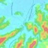
Gaspar Mirim topographic map

Click on the map to display elevation.

About this map

Name: Gaspar Mirim topographic map, elevation, terrain.

Location: Gaspar Mirim, Gaspar, Santa Catarina, Região Sul, Brasil (-26.97766 -48.96411 -26.93666 -48.92317)

Average elevation: 37 m

Minimum elevation: 2 m

Maximum elevation: 213 m

Other topographic maps

Click on a map to view its topography, its elevation and its terrain.
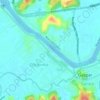
Rio Itajaí-Açu

Brasil > Santa Catarina > Gaspar

Average elevation: 14 m

Fundos Poço Grande

Brasil > Santa Catarina > Gaspar

Average elevation: 40 m

Gasparinho Central

Brasil > Santa Catarina > Gaspar

Average elevation: 135 m

Morro do Serrote

Brasil > Santa Catarina > Gaspar

Average elevation: 228 m

Gear up for your next adventure:

🥾Light Hiking Boots - Lightweight and comfortable boots for day hikes
🛁Quick-Dry Microfiber Towel - Space-saving towel that dries rapidly on the move
🛶Kayak Dry Bag - Waterproof storage for kayaking adventures
🧴Sunscreen SPF - Broad-spectrum sunscreen for outdoor activities
🧼Travel Hand Sanitizer - Keep hands clean when water is scarce

As an Amazon Associate, this site earns from qualifying purchases at no extra cost to you.