Geolocate

Cayuga topographic map

Click on the map to display elevation.

About this map

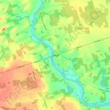
Name: Cayuga topographic map, elevation, terrain.

Location: Cayuga, Haldimand County, Ontario, N0A 1E0, Canada (42.90973 -79.89854 42.98973 -79.81854)

Average elevation: 196 m

Minimum elevation: 173 m

Maximum elevation: 217 m

Haldimand County trails, hiking, mountain biking, running and outdoor activities

Gear up for your next adventure:

🥾Mountain Hiking Boots - High-traction boots for rocky terrain
💧Hydration Bladder - Hands-free hydration solution for long treks
💧Reusable Water Bottle - Durable water bottles for hydration on trails
🧤Rechargeable Heated Gloves - Extreme warmth for Canadian winter expeditions
🚲Bike Repair Kit - Essential tools for on-trail mechanical issues

As an Amazon Associate, this site earns from qualifying purchases at no extra cost to you.