Geolocate

Bruchsal topographic map

Click on the map to display elevation.

About this map

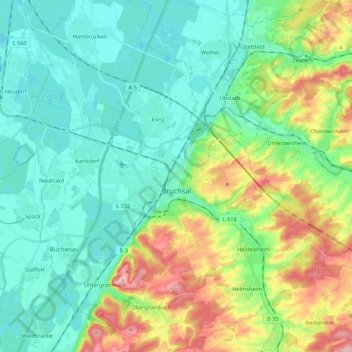
Name: Bruchsal topographic map, elevation, terrain.

Location: Bruchsal, Verwaltungsgemeinschaft Bruchsal, Landkreis Karlsruhe, Baden-Württemberg, 76646, Germany (49.05952 8.50816 49.20043 8.68969)

Average elevation: 147 m

Minimum elevation: 100 m

Maximum elevation: 268 m

Other topographic maps

Click on a map to view its topography, its elevation and its terrain.

Gear up for your next adventure:

🛁Quick-Dry Microfiber Towel - Space-saving towel that dries rapidly on the move
🥾Waterproof Hiking Boots - Essential footwear for rugged terrain and wet Canadian trails
🛏️Sleeping Bag - Warm and compact sleeping bags for outdoor camping
🥽Outdoor Goggles - Protective eyewear for outdoor activities
🥾Trail Hiking Socks - Comfortable socks to prevent blisters and fatigue

As an Amazon Associate, this site earns from qualifying purchases at no extra cost to you.