Geolocate

Calaca topographic map

Click on the map to display elevation.

About this map

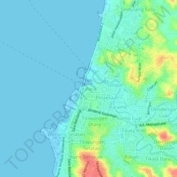
Name: Calaca topographic map, elevation, terrain.

Location: Calaca, Manado, North Sulawesi, 95122, Indonesia (1.47502 124.82089 1.51502 124.86089)

Average elevation: 11 m

Minimum elevation: 0 m

Maximum elevation: 58 m

Gear up for your next adventure:

🔋Lithium AA Batteries - Long-lasting power that performs in extreme cold
👖Convertible Hiking Pants - Zip-off legs to adapt to changing weather conditions
🧥Insulated Jacket - Keep warm in cold outdoor conditions
🥾Approach Boots - Comfortable boots for hiking and climbing approaches
🧢Beanie Hat - Keep your head warm in cold weather

As an Amazon Associate, this site earns from qualifying purchases at no extra cost to you.