Geolocate

Congiunti topographic map

Click on the map to display elevation.

About this map
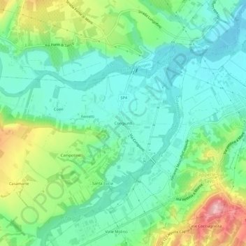
Name: Congiunti topographic map, elevation, terrain.

Location: Congiunti, Collecorvino, Pescara, Abruzzo, 65010, Italia (42.45360 14.06300 42.49360 14.10300)

Average elevation: 66 m

Minimum elevation: 10 m

Maximum elevation: 196 m

Gear up for your next adventure:

🐕Hiking Dog Pack - Let your canine companion carry their own water and food
🗺️Topographic Maps - Detailed maps to explore trails, mountains, and wilderness areas
🧦Hiking Socks - Moisture-wicking and comfortable socks for long hikes
🌬️Windproof Camp Stove - Efficient cooking even on exposed mountain peaks
🎒Hiking Backpack - Lightweight and ergonomic backpacks for day hikes or multi-day treks

As an Amazon Associate, this site earns from qualifying purchases at no extra cost to you.