Geolocate

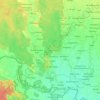
Chisapani topographic map

Click on the map to display elevation.

About this map

Name: Chisapani topographic map, elevation, terrain.

Location: Chisapani, Lamkichuha, Kailali, Sudurpashchim Province, Nepal (28.62349 81.26144 28.66349 81.30144)

Average elevation: 429 m

Minimum elevation: 190 m

Maximum elevation: 1,078 m

Other topographic maps

Click on a map to view its topography, its elevation and its terrain.

Chure

Nepal > Sudurpashchim Province > Kailali

Average elevation: 939 m

Bhajani

Nepal > Sudurpashchim Province > Kailali

Average elevation: 152 m

Bhajani

Nepal > Sudurpashchim Province > Kailali

Average elevation: 152 m

Gear up for your next adventure:

🥾Trekking Boots - Durable boots for long-distance trekking
🚑Survival Whistle - Signal for help across long distances in mountains
🔥Camping Stove - Portable stoves to cook outdoors with ease
🧢Beanie Hat - Keep your head warm in cold weather
🧥Waterproof Pants - Keep dry during rainy hiking conditions

As an Amazon Associate, this site earns from qualifying purchases at no extra cost to you.