
رعل topographic map
Interactive map
Click on the map to display elevation.
About this map
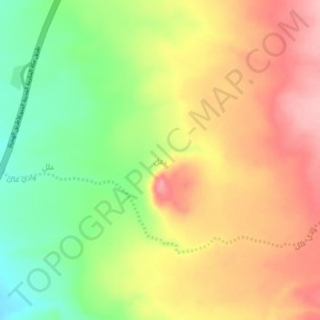
Name: رعل topographic map, elevation, terrain.
Location: رعل, محافظة وادي الفرع, Médine, Arabie saoudite (23.02219 39.94137 23.06219 39.98137)
Average elevation: 1,305 m
Minimum elevation: 1,230 m
Maximum elevation: 1,373 m
Other topographic maps
Click on a map to view its topography, its elevation and its terrain.
Médine
Médine, Al-Madina al-Mounawwara, Médine, 41419, Arabie saoudite
Average elevation: 692 m
Hamna
Hamna, محافظة وادي الفرع, Médine, Arabie saoudite
Average elevation: 1,183 m
Al Montazah
Al Montazah, محافظة المهد, Médine, Arabie saoudite
Average elevation: 996 m
محافظة العلا
محافظة العلا, Médine, 20115, Arabie saoudite
Average elevation: 929 m
Al-ʿUla
Al-ʿUla, محافظة العلا, Médine, Arabie saoudite
Average elevation: 748 m