Geolocate

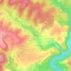
Hautmougey topographic map

Click on the map to display elevation.

About this map

Name: Hautmougey topographic map, elevation, terrain.

Location: Hautmougey, La Vôge-les-Bains, Épinal, Vosges, Grand Est, France métropolitaine, 88240, France (48.01044 6.20649 48.04230 6.26633)

Average elevation: 335 m

Minimum elevation: 267 m

Maximum elevation: 436 m

Other topographic maps

Click on a map to view its topography, its elevation and its terrain.

Le Pont du Coney

France > Grand Est > Vosges > La Vôge-les-Bains

Average elevation: 322 m

Le Raval

France > Grand Est > Vosges > La Vôge-les-Bains

Average elevation: 373 m

La Ricane

France > Grand Est > Vosges > La Vôge-les-Bains

Average elevation: 369 m

La Verrière

France > Grand Est > Vosges > La Vôge-les-Bains

Average elevation: 369 m

Gear up for your next adventure:

💡LED Headlamp - Hands-free illumination for night hiking and camping
🧰Multitool Knife - Compact and versatile tool for outdoor use
🥤Collapsible Travel Cup - Saves space and weight in your mess kit
👖Convertible Hiking Pants - Zip-off legs to adapt to changing weather conditions
🕶️Polarized Sunglasses - Protect your eyes with durable polarized lenses

As an Amazon Associate, this site earns from qualifying purchases at no extra cost to you.