Geolocate

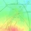
Socond topographic map

Click on the map to display elevation.

About this map

Name: Socond topographic map, elevation, terrain.

Location: Socond, Satu Mare, Romania (47.48344 22.90389 47.58818 23.05307)

Average elevation: 224 m

Minimum elevation: 141 m

Maximum elevation: 373 m

Other topographic maps

Click on a map to view its topography, its elevation and its terrain.

Corund

Romania > Satu Mare

Average elevation: 210 m

Lelei

Romania > Satu Mare

Average elevation: 252 m

Carei

Romania > Satu Mare

Average elevation: 136 m

Petea

Romania > Satu Mare

Average elevation: 121 m

Giurtelecu Hododului

Romania > Satu Mare

Average elevation: 239 m

Cean

Romania > Satu Mare

Average elevation: 186 m

Sătmărel

Romania > Satu Mare > Satu Mare

Average elevation: 121 m

Decebal

Romania > Satu Mare

Average elevation: 120 m

Gear up for your next adventure:

🥾Hiking Gaiters - Protect legs and shoes from mud, snow, and debris
💡Solar Camping Lamp - Eco-friendly lighting for campsites
🥾Hiking Leggings - Comfortable leggings for outdoor activities
🧭GPS Tracker - Track your location in remote areas safely
🛶Waterproof Dry Bags - Keep electronics and clothes dry during river crossings

As an Amazon Associate, this site earns from qualifying purchases at no extra cost to you.