Geolocate

Coconi topographic map

Click on the map to display elevation.

About this map

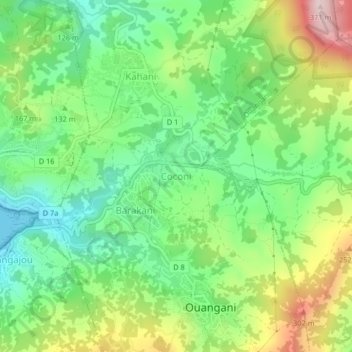
Name: Coconi topographic map, elevation, terrain.

Location: Coconi, Ouangani, Mayotte, 97670, France (-12.85428 45.11545 -12.81428 45.15545)

Average elevation: 130 m

Minimum elevation: 0 m

Maximum elevation: 359 m

Gear up for your next adventure:

🧶550 Survival Paracord - Versatile utility cord for emergency repairs and rigging
🔥Emergency Fire Starter - Reliable ignition source for all weather conditions
🥾Trail Hiking Shoes - Durable shoes designed for rugged trails
🔋Lithium AA Batteries - Long-lasting power that performs in extreme cold
🛶Kayak Accessories - Essential gear for safe and fun kayaking adventures

As an Amazon Associate, this site earns from qualifying purchases at no extra cost to you.