
Thank you for supporting this site ❤️
Make a donation
Make a donation
Gear up for your next adventure:
As an Amazon Associate, this site earns from qualifying purchases at no extra cost to you.
Manne topographic map
Click on the map to display elevation.
Thank you for supporting this site ❤️
Make a donation
Make a donation
Gear up for your next adventure:
As an Amazon Associate, this site earns from qualifying purchases at no extra cost to you.
About this map
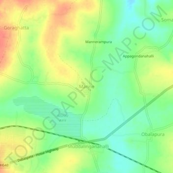
Name: Manne topographic map, elevation, terrain.
Location: Manne, Nelamangala taluk, Bangalore Rural, Karnataka, Inde (13.23535 77.27617 13.27535 77.31617)
Average elevation: 906 m
Minimum elevation: 883 m
Maximum elevation: 932 m
Thank you for supporting this site ❤️
Make a donation
Make a donation
Gear up for your next adventure:
As an Amazon Associate, this site earns from qualifying purchases at no extra cost to you.