Geolocate

Tablazo Norte topographic map

Click on the map to display elevation.

About this map

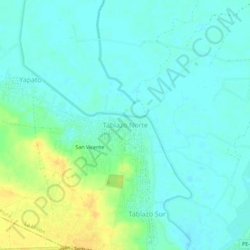
Name: Tablazo Norte topographic map, elevation, terrain.

Location: Tablazo Norte, La Unión, Piura, Perú (-5.40063 -80.78257 -5.36063 -80.74257)

Average elevation: 19 m

Minimum elevation: 11 m

Maximum elevation: 37 m

Gear up for your next adventure:

🛁Quick-Dry Microfiber Towel - Space-saving towel that dries rapidly on the move
🧢Outdoor Visor - Breathable visor for sunny hikes
🧴Sunscreen SPF - Broad-spectrum sunscreen for outdoor activities
🥾Trail Hiking Socks - Comfortable socks to prevent blisters and fatigue
🧢Sun Hat - Wide-brim hat for sun protection

As an Amazon Associate, this site earns from qualifying purchases at no extra cost to you.