
City of Gloversville topographic map
Interactive map
Click on the map to display elevation.
About this map
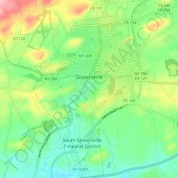
Name: City of Gloversville topographic map, elevation, terrain.
Average elevation: 262 m
Minimum elevation: 204 m
Maximum elevation: 376 m
The city sits in the foothills of the Adirondack Mountains and therefore is within a climatic transition zone. Gloversville experiences the warmer summer temperatures common throughout the Capital Region, Hudson Valley, and Mohawk Valley while experiencing generally more copious precipitation throughout the year than the Capital Region. This manifests in commonplace rolling thunderstorms throughout the summer months and snowfall amounts more akin to the lake-pocked higher elevations of the Adirondacks in the winter months.
Other topographic maps
Click on a map to view its topography, its elevation and its terrain.
Town of Mayfield
United States > New York > Fulton County
Town of Mayfield, Fulton County, New York, 12117, United States
Average elevation: 334 m