
Thank you for supporting this site ❤️
Make a donation
Make a donation
Gear up for your next adventure:
As an Amazon Associate, this site earns from qualifying purchases at no extra cost to you.
Lünersee topographic map
Click on the map to display elevation.
Thank you for supporting this site ❤️
Make a donation
Make a donation
Gear up for your next adventure:
As an Amazon Associate, this site earns from qualifying purchases at no extra cost to you.
About this map
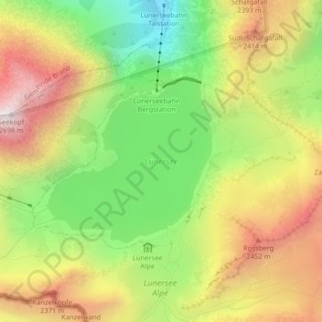
Name: Lünersee topographic map, elevation, terrain.
Location: Lünersee, Vandans, Bezirk Bludenz, Vorarlberg, Austria (47.04679 9.74063 47.06058 9.76115)
Average elevation: 2,106 m
Minimum elevation: 1,568 m
Maximum elevation: 2,682 m
Thank you for supporting this site ❤️
Make a donation
Make a donation
Gear up for your next adventure:
As an Amazon Associate, this site earns from qualifying purchases at no extra cost to you.