
Fischbach topographic map
Click on the map to display elevation.
Fischbach
Das Pfarrdorf bildet mit dem südlich gelegenen Tauschendorf eine geschlossene Siedlung. Diese liegt am Fischbach, einem linken Zufluss der Rodach. An der Südgrenze des Schlossgartens steht eine ungefähr 300 Jahre alte Sommerlinde mit einer Höhe von 15 Metern und einem Umfang von 3 Metern, die als Naturdenkmal geschützt ist. Die Kreisstraße KC 12 führt nach Wötzelsdorf (1,4 km südöstlich) bzw. nach Planersgut (1,4 km westlich). Gemeindeverbindungsstraßen führen nach Seibelsdorf zur Bundesstraße 303 (3 km östlich), nach Wüstbuch (1,7 km südwestlich) und nach Hinterstöcken (0,8 km westlich).
About this map
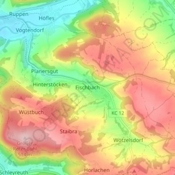
Name: Fischbach topographic map, elevation, terrain.
Average elevation: 414 m
Minimum elevation: 308 m
Maximum elevation: 512 m
Other topographic maps
Click on a map to view its topography, its elevation and its terrain.
96317
Deutschland > Bayern > Landkreis Kronach > Kronach > Seelabach > Wilhelmshöhe
Average elevation: 367 m