
Thank you for supporting this site ❤️
Make a donation
Make a donation
Gear up for your next adventure:
As an Amazon Associate, this site earns from qualifying purchases at no extra cost to you.
Barkhamsted topographic map
Click on the map to display elevation.
Thank you for supporting this site ❤️
Make a donation
Make a donation
Gear up for your next adventure:
As an Amazon Associate, this site earns from qualifying purchases at no extra cost to you.
About this map
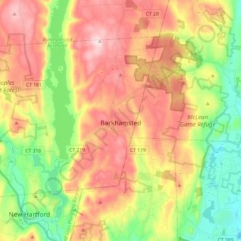
Name: Barkhamsted topographic map, elevation, terrain.
Location: Barkhamsted, Northwest Hills COG, Connecticut, United States (41.88728 -73.05365 41.97341 -72.88770)
Average elevation: 238 m
Minimum elevation: 69 m
Maximum elevation: 422 m
Thank you for supporting this site ❤️
Make a donation
Make a donation
Gear up for your next adventure:
As an Amazon Associate, this site earns from qualifying purchases at no extra cost to you.