Geolocate

Scheggia topographic map

Click on the map to display elevation.

About this map
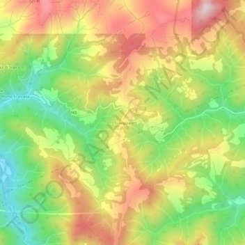
Name: Scheggia topographic map, elevation, terrain.

Location: Scheggia, Anghiari, Arezzo, Toscana, Italia (43.52847 11.94468 43.56847 11.98468)

Average elevation: 536 m

Minimum elevation: 316 m

Maximum elevation: 763 m

Gear up for your next adventure:

🧭GPS Tracker - Track your location in remote areas safely
👟Trail Running Shoes - Agile footwear for fast-paced topographic exploration
⛺Camping Groundsheet - Protect your tent from moisture and dirt
🛌Insulated Sleeping Pad - Critical thermal barrier between you and the cold ground
🧦Thermal Socks - Warm socks for winter hiking or camping

As an Amazon Associate, this site earns from qualifying purchases at no extra cost to you.