Geolocate

Altamont topographic map

Click on the map to display elevation.

About this map

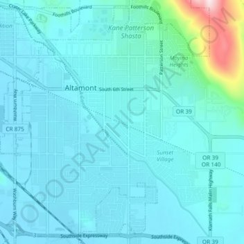
Name: Altamont topographic map, elevation, terrain.

Location: Altamont, Klamath County, Oregon, 97603, United States (42.17328 -121.75714 42.22499 -121.68340)

Average elevation: 1,285 m

Minimum elevation: 1,243 m

Maximum elevation: 1,646 m

Gear up for your next adventure:

🎒Fully Waterproof Backpack - Total protection for photography gear and electronics
🥾Light Trekking Boots - Supportive boots for multi-day treks
🚲Bike Repair Kit - Essential tools for on-trail mechanical issues
🧭GPS Outdoor Watch - Smart watch for navigation and fitness tracking in nature
🥾Trail Hiking Socks - Comfortable socks to prevent blisters and fatigue

As an Amazon Associate, this site earns from qualifying purchases at no extra cost to you.