Geolocate

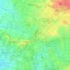
Barangay 36 topographic map

Click on the map to display elevation.

About this map

Name: Barangay 36 topographic map, elevation, terrain.

Location: Barangay 36, Zone 4, Marulas, District 2, Caloocan, Northern Manila District, Metro Manila, Philippines (14.63556 120.97675 14.63738 120.97991)

Average elevation: 10 m

Minimum elevation: -1 m

Maximum elevation: 23 m

Other topographic maps

Click on a map to view its topography, its elevation and its terrain.
Caybiga

Philippines > Caloocan

Average elevation: 38 m

Caybiga

Philippines > Caloocan

Average elevation: 38 m

Caybiga

Philippines > Caloocan

Average elevation: 38 m

Gear up for your next adventure:

🧢Sun Protection Cap - Breathable cap to protect from sun exposure
🥽Outdoor Goggles - Protective eyewear for outdoor activities
🥾Trail Hiking Boots - Supportive boots for rough trails
🧴Waterproofing Spray - Restore the DWR coating on jackets and tents
💡Solar Camping Lamp - Eco-friendly lighting for campsites

As an Amazon Associate, this site earns from qualifying purchases at no extra cost to you.