Geolocate

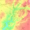
Chester topographic map

Click on the map to display elevation.

About this map

Name: Chester topographic map, elevation, terrain.

Location: Chester, Wayne County, Indiana, 47392, United States (39.86810 -84.90774 39.90810 -84.86774)

Average elevation: 330 m

Minimum elevation: 300 m

Maximum elevation: 357 m

Other topographic maps

Click on a map to view its topography, its elevation and its terrain.
Cambridge City

United States > Indiana > Wayne County

Average elevation: 292 m

Richmond

United States > Indiana > Wayne County

Average elevation: 314 m

Whitewater

United States > Indiana > Wayne County

Average elevation: 343 m

Fountain City

United States > Indiana > Wayne County

Average elevation: 340 m

Cambridge City

United States > Indiana > Wayne County

Average elevation: 292 m

Richmond

United States > Indiana > Wayne County

Average elevation: 314 m

Milton

United States > Indiana > Wayne County

Average elevation: 289 m

Gear up for your next adventure:

🛶Kayak Dry Bag - Waterproof storage for kayaking adventures
🧢Sun Protection Cap - Breathable cap to protect from sun exposure
🧦Merino Wool Socks - Moisture-wicking comfort for long-distance hiking
🥾Mountain Trail Shoes - High-traction shoes for mountain trails
🥾Hiking Leggings - Comfortable leggings for outdoor activities

As an Amazon Associate, this site earns from qualifying purchases at no extra cost to you.