Geolocate

Agliè topographic map

Click on the map to display elevation.

About this map

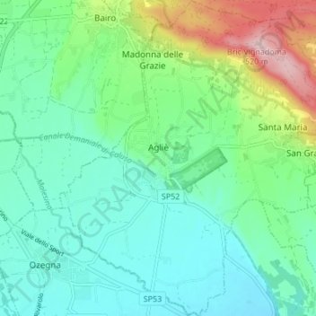
Name: Agliè topographic map, elevation, terrain.

Location: Agliè, Torino, Piemont, 10011, Italy (45.34149 7.74574 45.38920 7.80301)

Average elevation: 339 m

Minimum elevation: 277 m

Maximum elevation: 517 m

Gear up for your next adventure:

🥾Trail Running Shoes - Lightweight and durable shoes for trail running
🥾Waterproof Hiking Boots - Essential footwear for rugged terrain and wet Canadian trails
🛰️Satellite Messenger - Emergency communication for areas with no cell service
💧Reusable Water Bottle - Durable water bottles for hydration on trails
🧥Fleece Jacket - Warm and lightweight jacket for layering

As an Amazon Associate, this site earns from qualifying purchases at no extra cost to you.