Geolocate

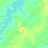
Sindhora topographic map

Click on the map to display elevation.

About this map

Name: Sindhora topographic map, elevation, terrain.

Location: Sindhora, Berasia Tahsil, Bhopal, Madhya Pradesh, India (23.81754 77.23251 23.85754 77.27251)

Average elevation: 446 m

Minimum elevation: 417 m

Maximum elevation: 534 m

Other topographic maps

Click on a map to view its topography, its elevation and its terrain.

Undrai

India > Madhya Pradesh > Berasia Tahsil > Undrai

Average elevation: 497 m

Birahi

India > Madhya Pradesh > Berasia Tahsil > Imaliya Swaroop

Average elevation: 474 m

Bagsi

India > Madhya Pradesh > Berasia Tahsil > Bagsi

Average elevation: 458 m

Khitwas

India > Madhya Pradesh > Berasia Tahsil > Khitwas

Average elevation: 486 m

Jaitpura

India > Madhya Pradesh > Berasia Tahsil

Average elevation: 488 m

Arrol Raisingh

India > Madhya Pradesh > Berasia Tahsil

Average elevation: 449 m

Gunga

India > Madhya Pradesh > Berasia Tahsil

Average elevation: 498 m

Gunga

India > Madhya Pradesh > Berasia Tahsil

Average elevation: 498 m

Gear up for your next adventure:

🛌Insulated Sleeping Pad - Critical thermal barrier between you and the cold ground
🦶Hiking Shoe Insoles - Added support for high arches and long days on feet
🌬️Windproof Camp Stove - Efficient cooking even on exposed mountain peaks
🔥Emergency Fire Starter - Reliable ignition source for all weather conditions
💡Compact LED Flashlight - Powerful and portable flashlight for outdoor use

As an Amazon Associate, this site earns from qualifying purchases at no extra cost to you.