Geolocate

Colfacero topographic map

Click on the map to display elevation.

About this map

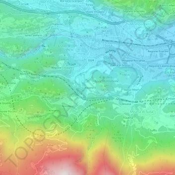
Name: Colfacero topographic map, elevation, terrain.

Location: Colfacero, Gravere, Torino, Piemonte, 10059, Italia (45.10750 7.02717 45.14750 7.06717)

Average elevation: 755 m

Minimum elevation: 470 m

Maximum elevation: 1,555 m

Gear up for your next adventure:

🥾All-Terrain Hiking Boots - Versatile boots for varied hiking conditions
🧢Hiking Hat - Sun-protective and breathable hats for long treks
🧥Waterproof Jacket - Lightweight rain jackets for hiking and outdoor activities
🔪Outdoor Multitool - Versatile tool for repairs and food prep in the wild
🛶Waterproof Dry Bags - Keep electronics and clothes dry during river crossings

As an Amazon Associate, this site earns from qualifying purchases at no extra cost to you.