
Evans City topographic map
Click on the map to display elevation.
About this map
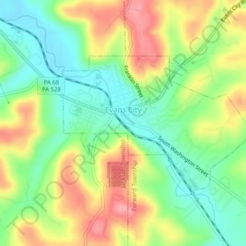
Name: Evans City topographic map, elevation, terrain.
Location: Evans City, Butler County, Pennsylvania, United States (40.76031 -80.07169 40.77511 -80.04419)
Average elevation: 324 m
Minimum elevation: 277 m
Maximum elevation: 384 m
Other topographic maps
Click on a map to view its topography, its elevation and its terrain.
Glade Mills
United States > Pennsylvania > Butler County > Middlesex Township
Average elevation: 359 m
Butler Farm Show Lake
United States > Pennsylvania > Butler County > Meridian
Average elevation: 392 m