Geolocate

Zibarco topographic map

Click on the map to display elevation.

About this map

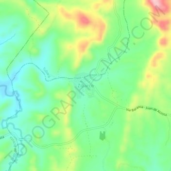
Name: Zibarco topographic map, elevation, terrain.

Location: Zibarco, Baranoa, Atlántico, Colombia (10.79531 -74.99552 10.83531 -74.95552)

Average elevation: 169 m

Minimum elevation: 105 m

Maximum elevation: 289 m

Gear up for your next adventure:

🥾Waterproof Hiking Shoes - Durable shoes for wet and rugged trails
🥾Light Trekking Boots - Supportive boots for multi-day treks
🧢Hiking Hat - Sun-protective and breathable hats for long treks
🍽️Titanium Camping Spork - Ultralight and indestructible eating utensil
🪑Insulated Seat Pad - Protect your seat from cold rocks and wet logs

As an Amazon Associate, this site earns from qualifying purchases at no extra cost to you.