
Villar del Rey topographic map
Interactive map
Click on the map to display elevation.
About this map
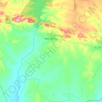
Name: Villar del Rey topographic map, elevation, terrain.
Average elevation: 257 m
Minimum elevation: 187 m
Maximum elevation: 422 m
Other topographic maps
Click on a map to view its topography, its elevation and its terrain.
Pozo Cortijo
España > Extremadura > Tierra de Badajoz > Villar del Rey
Pozo Cortijo, Villar del Rey, Tierra de Badajoz, Badajoz, Extremadura, 06192, España
Average elevation: 247 m