

Wüstenbrand topographic map
Click on the map to display elevation.
Wüstenbrand
Wüstenbrand befindet sich östlich von Hohenstein-Ernstthal am „Rabensteiner Höhenzug“, der den Nordrand des Erzgebirgsbeckens vom Südrand des Mittelsächsischen Lößlehm-Hügellandes trennt. Nordwestlich von Wüstenbrand befindet sich das Landschaftsschutzgebiet „Pfaffenberg–Oberwald“ mit der Langenberger Höhe (484 m ü. NHN), nordöstlich des Orts liegt der Rabensteiner Wald mit dem Totenstein (483 m ü. NHN). Höchste Erhebung des Orts ist der Heidelberg (450 m ü. NHN) mit seinem Aussichtsturm.
About this map
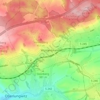
Name: Wüstenbrand topographic map, elevation, terrain.
Average elevation: 396 m
Minimum elevation: 310 m
Maximum elevation: 480 m
Other topographic maps
Click on a map to view its topography, its elevation and its terrain.
