Geolocate

Chianale topographic map

Click on the map to display elevation.

About this map

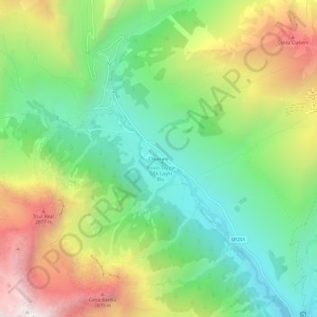
Name: Chianale topographic map, elevation, terrain.

Location: Chianale, Pontechianale, Cuneo, Piemonte, Italia (44.62665 6.97869 44.66665 7.01869)

Average elevation: 2,223 m

Minimum elevation: 1,660 m

Maximum elevation: 3,108 m

Other topographic maps

Click on a map to view its topography, its elevation and its terrain.

Varaita di Chianale

Italia > Piemonte > Cuneo > Pontechianale > Castello

Average elevation: 1,793 m

Gear up for your next adventure:

🥾Trekking Boots - Durable boots for long-distance trekking
🥾Mountain Trail Shoes - High-traction shoes for mountain trails
🧢Hiking Hat - Sun-protective and breathable hats for long treks
🧰Survival Kit - Essential gear for emergencies in the wilderness
🥾Waterproof Hiking Shoes - Durable shoes for wet and rugged trails

As an Amazon Associate, this site earns from qualifying purchases at no extra cost to you.