Geolocate

Saro topographic map

Click on the map to display elevation.

About this map

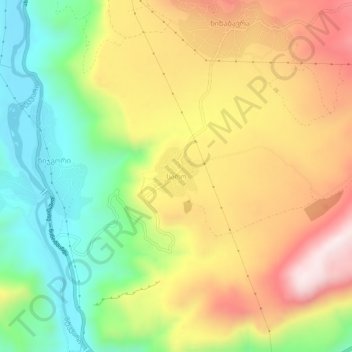
Name: Saro topographic map, elevation, terrain.

Location: Saro, Aspindza Municipality, Samtskhe-Javakheti, Georgia (41.48467 43.26228 41.52467 43.30228)

Average elevation: 1,375 m

Minimum elevation: 1,091 m

Maximum elevation: 1,694 m

Other topographic maps

Click on a map to view its topography, its elevation and its terrain.

Gear up for your next adventure:

📷Outdoor Action Camera - Capture high-elevation views and rugged adventures
🧰Multitool Knife - Compact and versatile tool for outdoor use
🦌Outdoor Trail Camera - Monitor wildlife activity near your favorite spots
🧢Sun Protection Cap - Breathable cap to protect from sun exposure
🥾Waterproof Hiking Shoes - Durable shoes for wet and rugged trails

As an Amazon Associate, this site earns from qualifying purchases at no extra cost to you.