Geolocate

Punta Massullo topographic map

Click on the map to display elevation.

About this map

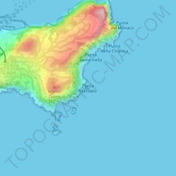
Name: Punta Massullo topographic map, elevation, terrain.

Location: Punta Massullo, Capri, Naples, Campania, 80073, Italy (40.54678 14.25934 40.54688 14.25944)

Average elevation: 41 m

Minimum elevation: -3 m

Maximum elevation: 321 m

Gear up for your next adventure:

🥾Mountain Hiking Shoes - Shoes with superior grip for mountainous terrain
🌬️Windproof Camp Stove - Efficient cooking even on exposed mountain peaks
🧢Outdoor Visor - Breathable visor for sunny hikes
🥾Durable Hiking Shoes - Long-lasting shoes for frequent hiking
Tent Footprint - Protect tent floor and increase durability

As an Amazon Associate, this site earns from qualifying purchases at no extra cost to you.