
Thirsk topographic map
Interactive map
Click on the map to display elevation.
About this map
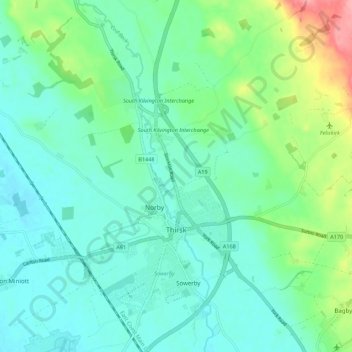
Name: Thirsk topographic map, elevation, terrain.
Location: Thirsk, Hambleton, North Yorkshire, Angleterre, Royaume-Uni (54.22469 -1.40273 54.26030 -1.29324)
Average elevation: 47 m
Minimum elevation: 23 m
Maximum elevation: 125 m