
Thank you for supporting this site ❤️
Make a donation
Make a donation
Gear up for your next adventure:
As an Amazon Associate, this site earns from qualifying purchases at no extra cost to you.
Bouhriz topographic map
Click on the map to display elevation.
Thank you for supporting this site ❤️
Make a donation
Make a donation
Gear up for your next adventure:
As an Amazon Associate, this site earns from qualifying purchases at no extra cost to you.
About this map
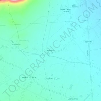
Name: Bouhriz topographic map, elevation, terrain.
Location: Bouhriz, Guellal, Daïra Aïn Oulmane, Sétif, Algérie (35.98173 5.21595 36.02173 5.25595)
Average elevation: 914 m
Minimum elevation: 886 m
Maximum elevation: 1,084 m
Thank you for supporting this site ❤️
Make a donation
Make a donation
Gear up for your next adventure:
As an Amazon Associate, this site earns from qualifying purchases at no extra cost to you.