
Municipalité de Choumen topographic map
Interactive map
Click on the map to display elevation.
About this map
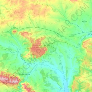
Name: Municipalité de Choumen topographic map, elevation, terrain.
Location: Municipalité de Choumen, Oblast de Choumen, Bulgarie (43.10282 26.73112 43.43398 27.21361)
Average elevation: 240 m
Minimum elevation: 59 m
Maximum elevation: 717 m
Il se trouve à une altitude de 450 m et peut être vu jusqu'à 30 km.
Other topographic maps
Click on a map to view its topography, its elevation and its terrain.
Madara
Bulgarie > Oblast de Choumen > Municipalité de Choumen
Madara, Municipalité de Choumen, Oblast de Choumen, 9971, Bulgarie
Average elevation: 190 m