
Thank you for supporting this site ❤️
Make a donation
Make a donation
Gear up for your next adventure:
As an Amazon Associate, this site earns from qualifying purchases at no extra cost to you.
Eruthukaranpatti topographic map
Click on the map to display elevation.
Thank you for supporting this site ❤️
Make a donation
Make a donation
Gear up for your next adventure:
As an Amazon Associate, this site earns from qualifying purchases at no extra cost to you.
About this map
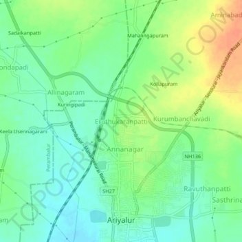
Name: Eruthukaranpatti topographic map, elevation, terrain.
Location: Eruthukaranpatti, Ariyalur, Tamil Nadu, 621704, India (11.13209 79.05233 11.17209 79.09233)
Average elevation: 80 m
Minimum elevation: 64 m
Maximum elevation: 105 m
Thank you for supporting this site ❤️
Make a donation
Make a donation
Gear up for your next adventure:
As an Amazon Associate, this site earns from qualifying purchases at no extra cost to you.