
Thank you for supporting this site ❤️
Make a donation
Make a donation
Gear up for your next adventure:
As an Amazon Associate, this site earns from qualifying purchases at no extra cost to you.
kazaure topographic map
Click on the map to display elevation.
Thank you for supporting this site ❤️
Make a donation
Make a donation
Gear up for your next adventure:
As an Amazon Associate, this site earns from qualifying purchases at no extra cost to you.
About this map
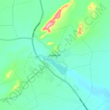
Name: kazaure topographic map, elevation, terrain.
Location: kazaure, Unguwar Arewa, Kazaure, Jigawa, Nigeria (12.61382 8.37481 12.69382 8.45481)
Average elevation: 462 m
Minimum elevation: 424 m
Maximum elevation: 610 m
Thank you for supporting this site ❤️
Make a donation
Make a donation
Gear up for your next adventure:
As an Amazon Associate, this site earns from qualifying purchases at no extra cost to you.