Geolocate

Autrans topographic map

Click on the map to display elevation.

About this map

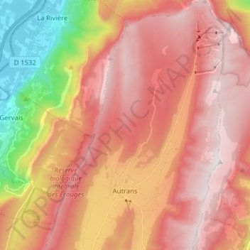
Name: Autrans topographic map, elevation, terrain.

Location: Autrans, Autrans-Méaudre en Vercors, Grenoble, Isère, Auvergne-Rhône-Alpes, Metropolitan France, 38880, France (45.15493 5.50828 45.24406 5.59854)

Average elevation: 1,111 m

Minimum elevation: 173 m

Maximum elevation: 1,709 m

Other topographic maps

Click on a map to view its topography, its elevation and its terrain.

Gear up for your next adventure:

🧥Insulated Jacket - Keep warm in cold outdoor conditions
🧥Ultralight Puffy Jacket - Maximum warmth that packs down to the size of an orange
🔭Outdoor Binoculars - Lightweight binoculars for birdwatching and hiking
🚲Handlebar Phone Mount - View topographic-map.com live while cycling
🧤Thermal Hiking Gloves - Grip-enhanced gloves for cold-weather altitude trekking

As an Amazon Associate, this site earns from qualifying purchases at no extra cost to you.