
Thank you for supporting this site ❤️
Make a donation
Make a donation
Gear up for your next adventure:
As an Amazon Associate, this site earns from qualifying purchases at no extra cost to you.
Deogarh topographic map
Click on the map to display elevation.
Thank you for supporting this site ❤️
Make a donation
Make a donation
Gear up for your next adventure:
As an Amazon Associate, this site earns from qualifying purchases at no extra cost to you.
About this map
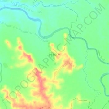
Name: Deogarh topographic map, elevation, terrain.
Location: Deogarh, Pachpahar Tehsil, Jhalawar, Rajasthan, India (24.09998 75.88297 24.13998 75.92297)
Average elevation: 409 m
Minimum elevation: 382 m
Maximum elevation: 451 m
Thank you for supporting this site ❤️
Make a donation
Make a donation
Gear up for your next adventure:
As an Amazon Associate, this site earns from qualifying purchases at no extra cost to you.