
Thank you for supporting this site ❤️
Make a donation
Make a donation
Gear up for your next adventure:
As an Amazon Associate, this site earns from qualifying purchases at no extra cost to you.
Guntramsdorf topographic map
Click on the map to display elevation.
Thank you for supporting this site ❤️
Make a donation
Make a donation
Gear up for your next adventure:
As an Amazon Associate, this site earns from qualifying purchases at no extra cost to you.
About this map
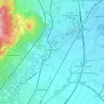
Name: Guntramsdorf topographic map, elevation, terrain.
Location: Guntramsdorf, Bezirk Mödling, Lower Austria, 2353, Austria (48.02271 16.27144 48.07193 16.36444)
Average elevation: 215 m
Minimum elevation: 177 m
Maximum elevation: 441 m
Thank you for supporting this site ❤️
Make a donation
Make a donation
Gear up for your next adventure:
As an Amazon Associate, this site earns from qualifying purchases at no extra cost to you.