
Alumbrado topographic map
Click on the map to display elevation.
About this map
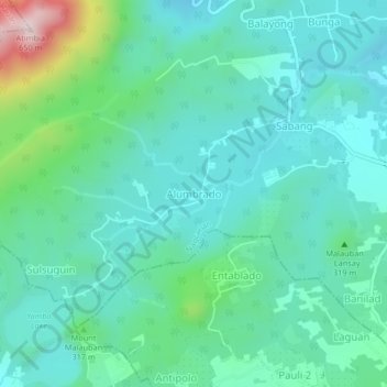
Name: Alumbrado topographic map, elevation, terrain.
Location: Alumbrado, Nagcarlan, Laguna, Calabarzon, 4002, Philippines (14.11220 121.36313 14.15220 121.40313)
Average elevation: 248 m
Minimum elevation: 149 m
Maximum elevation: 635 m
Other topographic maps
Click on a map to view its topography, its elevation and its terrain.
Mounts Banahaw–San Cristobal Protected Landscape
Philippines > Laguna > Nagcarlan
Average elevation: 707 m